DAINESE EXPLORER
Dainese Search

    Along collapsed roads and snowy passes between the Pyrenees and the Alps, to breathtaking cliffs over the Atlantic Ocean

    By Laurent Cochet | 01 September 2022 | 1 min
    Motorcycle: Honda NT 1100
    Mileage: 8.307 kms
    Difficulty: medium, the NT isn’t an off-road or snow bike
    Duration: 19 days
    Time of the year: April
    Weather: all types
    Temperatures: 0°C - 20°C
    Essential equipment: thermal underwear, suit with laminated waterproof membrane, extra rain suit, spare gloves, GPS navigator, 1:220,000 map
    cochet

    Laurent Cochet

    The author

    Passionate about bikes and travel, I love to meet people in France and around the world. One day I discovered the alchemy with which to perfectly combine these three elements – by telling stories. Whether it's writing books, posting on a social network or making videos for YouTube, I'm first and foremost a storyteller.

    I’m right in the middle of my ‘Contour de France’, not a ‘Tour de France’ like the one for cyclists. This is really the contour. The goal I set for myself this time is to ride my Honda NT1100 around the country, trying in every location to ride the road that follows the border most closely, even if it’s the narrowest and most winding. You’ll say that it’s nonsense. Well it’s not, because if France has a little more than 6,000 km of borders, the route I marked out measures more than 8,000! How is it possible? Easy – very often there’s no road along the border, so you have to be inventive and able to improvise, between dead ends, dirt roads that become enduro trails and so on. I set off from Paris and headed, to begin with, for La Rochelle, on the Atlantic coast. From there I continued south, around the Gironde estuary, then to the Basque country, the Spanish border and the Pyrenees. You can find the first part of my journey here: Traveling around France with Lolo Cochet, part 1 – from Paris to the Pyrenees 


    Enduro with NT1100 

    At Aldudes we really started to climb the mountain. And this is where things got more complicated. At a fork in the road, two guys were clearing two trees that had just fallen from the other side of the road with a chainsaw. There was a “road blocked” sign on the right, but one of the guys told me we could pass. “The road is only a little collapsed...” That’s one thing you should never tell me. Actually, it wasn’t that much of an adventure. It’s true, at two points in particular it looked like an ogre had been taking bites out of the asphalt. You definitely couldn’t pass in a car, but we didn’t have problems with the NT1100 sticking firmly to the rock face. I thought, “Good,” until we came to a huge scree. 

    There, the mountain had literally collapsed onto the road. It was something like an episode of Les Routes de l’impossible (“The roads of the impossible”). Marie and I went on a recon on foot. Of course, it wasn’t a highway and it wasn’t a road to be recommended either, but in the middle of all that mess there was a path, no doubt created by enduro bikes. I tried my luck, but on the sole condition that I was sure I could overcome the obstacle in the opposite direction. But wait, because the worst is yet to come. 

    I activated the traction control, engaged first gear, and the NT1100 took off at a good pace. The only problem is that, emerging from this obstacle, the road led me into a ditch, and it wasn’t so easy to get out! In any case, we did it. Right after Esterençuby, we stayed on the border on a road closed due to snow. On the dashboard, the temperature began to drop to two degrees C and it started snowing, so that the road became covered with white snow. Carefully, slowly, we reached a fork in the road. On the left it was possible to drop down to Iraty. On the right, the climb continued. Because I’m not so dumb, I realized that our adventure had come to an end. So we headed toward Iraty. The snow falling on our screens turned back to water. 

    Off-road digression with a perplexed NT
    Off-road digression with a perplexed NT

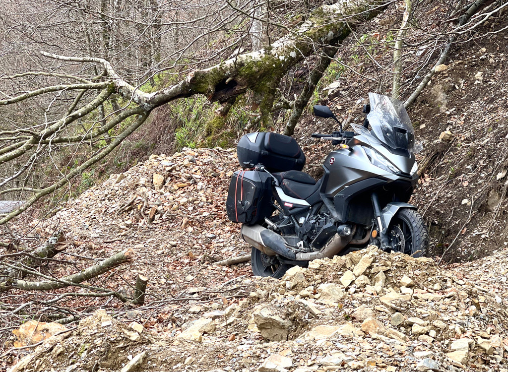
    The problem came up again. Col du Pourtalet – closed! So we stayed in the valley, coming off the main roads as much as possible. It was only just before Andorra that we were finally able to try to “get close to the peaks again” without getting stuck in the snow! On that subject, I recommend the lovely Col de Latrape. 

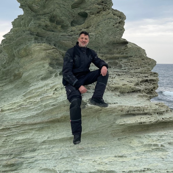
    Collioure, 956 kilometers later! Marie liked the seat and comfort of the NT1100, whose rear suspension had been slightly adjusted. The bike is certainly more flexible, but it’s still rigorous and offers even more comfort on the shock absorbers. With two people, the Africa Twin’s engine does its job too, responding well to even the slightest excess. Honestly, the NT always stays very agile, manageable and easy to ride in company as well as on your own. To make up for this mind-blowing trip, we stopped at a good seafood restaurant in Collioure.  


    The passes of the Alps and the Col de La Bonette amid snow and barriers 

    I have to say that after the Pyrenees, along the Mediterranean coast, yes, there are beautiful bird reserves after Narbonne. Yes, the Gruissan Plage chalets are a curiosity it’s worth seeing. Yes, the Camargue is beautiful, including the little Sauvage ferry (the ferry captain isn’t easy to get on with, maybe even a bit cold). Yes, the unique villas overlooking Saint-Jean-Cap-Ferrat and Beaulieu-sur-Mer are paradises, but come on, guys – La Grande Motte, Agde, Valras… let’s not kid ourselves! In Mentone I started THE climb, the one that would take me to Lille, but via the Alps, the Jura, and the Vosges. Wonderful, right? Sure, as long as the passes are open. 

    I changed my method a little, I admit. Instead of being led by my route decided late in the evening, I bought a lovely 1:220,000 paper map, the one that explains the alpine passes, the one you pull out in the evening in your hotel room and have to examine on your feet. You have to see it from above, as if you were in a helicopter, to get a real view of the situation and better understand it. Then I went on the Internet (yes, modernity can go hand in hand with this good old map) and examined the open passes. Castillon, Turini, Col Saint Martin, la Couillole – open! 

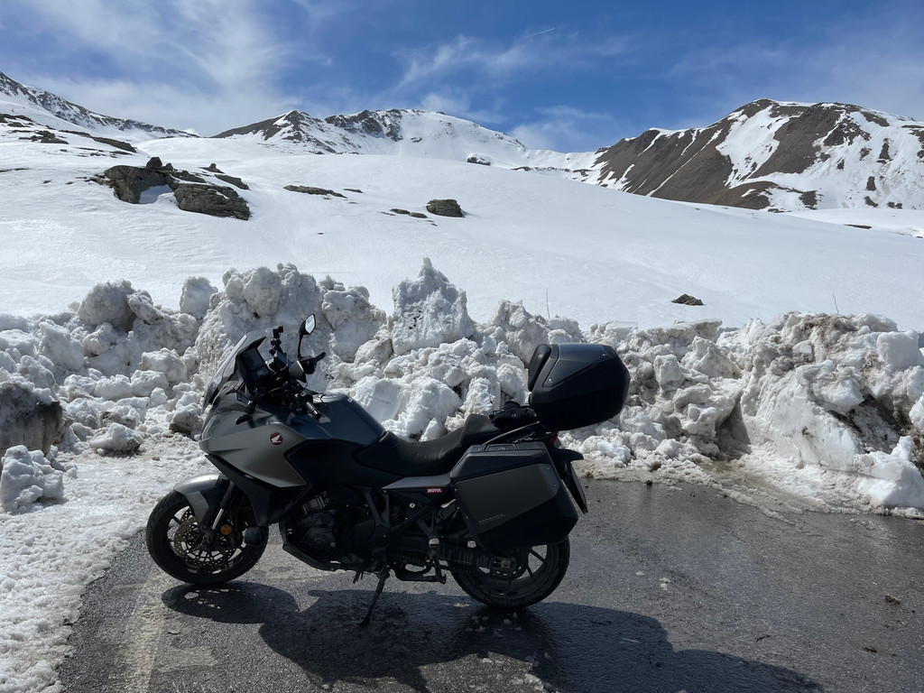
    These are the passes to focus on if you want to stay on the Italian border. Right, but some reports hint at the Col de la Bonette possibly being about to open. At 2,715 meters, it’s the highest road in Europe. Inviting, right? From the start of this journey, I’ve been circling, circumnavigating, reinterpreting and rethinking my path. It would be nice to play a little more, wouldn’t it? And if it didn’t work, I’d just have to take a 3-hour detour. In Saint-Étienne-de-Tinée I fill up with gas, water, and treat myself to buying a sandwich, to stick into my left bag. You never know. There at the bottom, the Bonette road is marked as closed. 

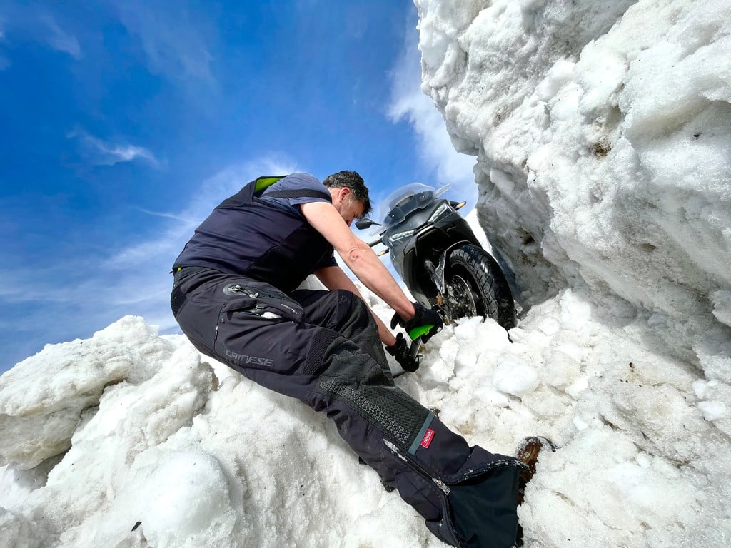
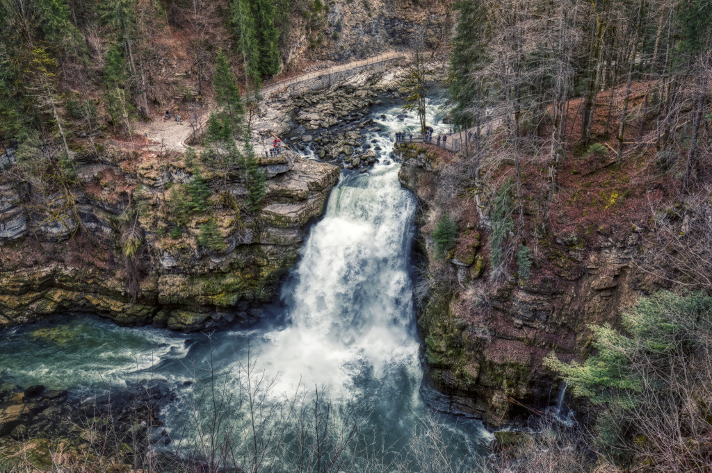
    It’s closed as closed can be. At the end of the day, it’s just an adjective. It means everything and nothing. At least I can satisfy my curiosity by pushing on to the last village before the Bonette, Bousiéyas. And it was a good decision, because you could get that far. It’s strange to see this little village, usually so lively, so deserted. Above Bousiéyas, other signs clearly indicate closure. Two motorcycle riders go up. For fun? To get to the snow? Who knows. I start to go up, too. What a torment to have to turn around… But I have no regrets, because it’s a real spectacle. There’s been very little snowfall in the Southern Alps and the pastures are emerging. The marmots seem to greet (or whistle at) my arrival. I film two of them, which seem to be engaged in an MMA fight, then to disappear into the same burrow. 


    If you know the Col de la Bonette, I go as far as the old military barracks, which protected access to the French Alpine valleys until 1944. The place is still quite atmospheric. I take a quick sandwich break. I tell myself it’s strange that this road is open. There’s no one around at all, a couple of marmots at most. I press forward another kilometer and discover what I should have seen at least half an hour ago when I was eating my sandwich, a huge wooden barrier. It was locked with a padlock, comprehensively blocking access on both sides. 


    Challenging fate – a little more enduro with the NT 

    On the left is the precipice, impossible to get past without overturning the bike. On the right is a huge pile of stones on the side of the mountain. I know, what I’m about to do is not OK. At that moment, a guy comes and says to me, “Do you want to pass?” “Yeah, I don’t know, maybe yes, maybe no, not really…” I don’t know what to do anymore with all these U-turns and these constant but irresistible temptations. You have to understand – being the first to take Europe’s highest road... The guy tells me that it’s “stupid to come here today.” I don’t dare contradict him, even if I find it an overly robust approach. But he continues, not to scold me for the dumb crap I’m about to pull, but to explain that it’s “stupid to stay blocked there, because it reopens tomorrow. Estrosi is coming here for a marketing gimmick, to say how beautiful our region is. They’re opening for him!” 

    What?! Christian Estrosi? The mayor of Nice? The Former Grand Prix rider who distinguished himself at the Bol d’Or, on the Moto Journal 200, in the Grand Prix as well as on the Pernod? There I said to myself, “Estrosi has already been on the podium. Now it’s my turn.” Besides, I wasn’t going to let a procession of limousines with leather interiors get the better of me – it wouldn’t be right! If an official sedan can climb it, so can a motorcycle. I remove the two NT1100 bags to gain some width. I remove the larger stones and manage to create a kind of ramp that’s fairly easy to use. On the other side, you’d have to dive into a snow-filled ravine. I turn off the traction control and slip into this den. The back slides a bit, but the NT1100 doesn’t hold back and defies the ban. 

    I hang up my bags again and set off on this deserted, unique road. There’s snow and there’s ice. I slalom between the stones. I take advantage of this unique occasion to climb calmly, drinking in this solitude and this immensity. When I arrive at the top, the ring surrounding La Bonette is still covered in snow. The small Restefonds passage to the other side can be taken, however. I enjoy a few more moments of happiness until… I run into a huge wall of snow. An impressive snowdrift interrupts my path and prevents access (descent in my case) from the pass to Jausiers and Barcelonnette. 

    U-turn? Absolutely out of the question. This time, I refuse. The snowdrift is thick and enormous. I take the shovel out of the top box and attack this giant meringue. I didn’t come all this way to make a U-turn. Besides, even if it means being the first through, I might as well dig the last passageway. An hour later, it’s done. In order not to make a complete fool of myself (even if it’s too late now, you’ll say), I studded the rear tire lightly with Best Grip mini studs for mountain bike tires. Penetration of only 6 mm into the tire allows you to equip a road tire (an enduro tire can take much larger studs in the tires). Contact, first and… off. The bike slides a little, but it passes. Ah, no! The bags are still there, on both sides. I widen the passage a little more and free the NT1100. 

    The Saut du Doubs
    The Saut du Doubs
    MicrosoftTeams-image (3)

    How to choose a motorcycle jacket for traveling

    Waterproof, perforated or four-season: the perfect touring equipment

    DISCOVER MORE

    And at that point? What do you think i did? I certainly didn’t want to abandon Annapurna leaving my trash behind after planting my flag! No, I picked up the shovel again to conscientiously fill the great passageway dug into the snowdrift. That way no one can fall into the hole of my stupidity. La Bonette, it’s done. I told you I’d get closer to the border in my Contour de France. It’s a calm ride to Barcelonnette. The Madeleine, the Glandon, the Izoar... no, I’m not challenging them with a pick and shovel. But this little ‘victory’ has done me good. Two days later, La Bonette is still closed and Estrosi hasn’t shown up. You see that being an idiot helps sometimes! 


    Highway monotony along the German border 

    After the beauty and thrill of the Alps, I fell into a black hole! It’s not hard to understand. A black hole – yes, come on, that area in space so compact that the intensity of its gravitational field prevents any kind of matter or radiation from escaping it. A black hole can’t emit or disperse light, so it’s... black! A black hole.  

    That’s what happened to me when I left the Alps. I’d conquered what there was to conquer in my Contour de France. The Col de Vars (with its cozy Napoleon hut at the top), Lauteret, Fresnes, Leschaux and then Les Gets. I went around Lake Annecy to dive into the Doubs. You’ll be saying, “It definitely happened in Mouthe, the coldest commune in France; that’s where the black hole thing happened to him.” As if! The weather was really great, even warm. With the Honda NT1100 I rode through Morteau to follow the meandering Doubs River and its colorful river shuttles leading to the famous Saut du Doubs waterfall. 

    With the NT I passed through the Rue des Combes, which overlooks the imposing canyon in a landscape similar to those in Canada. The Saut du Doubs is really curious. It was formed 12,000 years ago by the collapse of two valleys, producing a 27-meter-high waterfall. That’s how a geologist would describe it. For those with a poetic soul, however, it represents above all an opportunity to daydream while you kayak through it during high-water periods. With the NT, we didn’t get too close, just in case... Straight afterwards we visited Charquemont, Maîche, Saint-Hippolyte and Audincourt, traveling along narrow streets that were all curves and climbs. Congratulations, boys and girls – you have a magnificent region! There I said to myself, “Excellent, the Vosges await us.” But I would have been better off following geography lessons at school. Yes, because the Vosges massif stops just before the German border, basically getting in the way of my route. I had no choice but to fall into the black hole. 

    A succession of endless straights along the Rhine. Luckily there’s an election on, otherwise I’m afraid they would have taken away my license. Parking lots full of new cars ready for delivery (but wasn’t there a shortage of semiconductors?), parked under canopies made up of photovoltaic panels! Loading docks, stinking factories. Well, you can’t take it out on the Rhine. It does an outstanding job, supplying water to 30 million people and transporting more than 180 million metric tons of goods. Me and the NT1100, though – we’re really damn fed up with it. Don’t hold it against me, I apologize in advance for the language, but I just wouldn’t know how else to describe the situation. I wouldn’t chuck the whole region, but my route has gone to hell. On this side of France, you can’t follow the borders! Because of this idea of doing the Contour de France, I made some great discoveries and some distinctly less great ones. The problem is that a black hole is big, huge. I don’t think we even know how deep it is. And because there are no exceptions, the NT and I have been prisoners. I had to continue along the northern borders.

    17th-century fortification in Maubeuge
    17th-century fortification in Maubeuge

    More long straights between the Maginot Line and the Belgian border 

    Same observation – deadly boredom. For a moment, however, I thought I’d escaped the black hole when I got to the Ardennes. Long straights stretch out among the conifers, but the landscape is already more varied. I also saw signs pointing to Gedinne, Chimay! Cool, I could have a drink. But no. For me, Chimay and Gedinne are just the mythical names of the Belgian road cycling championships. But no dice, I didn’t go there. My GPS unquestionably wanted to stay in the black hole, so I carried on along the border. But then I objected. I said, “No, no, no, no,” and went for a ride to Maubeuge. I was hopeful about finding a flicker of excitement, a little bright spell on this road trip. But apparently it just wasn’t my day. It was Easter Monday, and the legendary Maubeuge was as deserted as if it were a day in lockdown. I return to the Maginot Line, its field fortifications, its universe of bricks. The walls are made of brick, the houses are made of brick, the chapels are made of brick. Only the money doesn’t seem to be made of bricks (and I say it affectionately).  

    In the north, the people are amazing. There was a good smell lingering in the countryside (this time), the smell of Easter Monday. Everywhere – flea markets, picnics – the people know how to have fun. It’s probably just me being stupid traveling all these miles. And that’s how, without even realizing it, just like I went in, I came out... out of the black hole! Bray-Dunes, high up in the north, right on the border with Belgium, the northernmost town in France. It’s much less well-known than North Cape (another northern tip, but in Europe), but Bray-Dunes is still worth a detour due to its characteristic charm. The main street, stores selling fries, ice creams, balls, rackets, and swimsuits. It’s like being at the beach, but with a sweater and a hat. Relax, I’m joking (although...). But come on, let’s go. We set off on the last leg of my Contour de France – Normandy and Brittany. 


    Brittany – the most beautiful region in France, according to some 

    Bretons crack me up. They claim to be different, to be authentic, but at the same time you see that they need recognition, to feel loved. It shows. They have to convince us, persuade us that their region is the most beautiful. Not that there’s anything wrong with that, but in Brittany it’s all fake, a facade. And I’ve been thinking that for a long time! Before the Bretons come in their red caps and smash my house up, let me explain why. My idea of Brittany goes back to an old memory, a really, really old one. It was 1998. The new Aprilia RSV Mille (Rotax twin-cylinder engine, well before the V4) had just come out. I’d been asked to compare a Ducati 996 and a Suzuki TL 1000 R. At the time I was young, attractive and innocent, and I really didn’t understand why testers never went to Brittany for their testing. What a great idea, right in the middle of December. Icy straights and horrible weather eventually forced us to backtrack. I remember the cover photo of the paper very well, the faces of three idiots, with frozen noses and a suit barely protecting us from the cold. I have no intention of rereading that comparison, or the distinguished opinion that I was able to (supposed to) offer on the dynamic qualities of these bikes. Sometimes journalists perform miracles! 


    How to choose the perfect helmet

    Guide to sizes, types and what to look out for

    Choosing a helmet isn’t something you can take for granted, especially when you’re starting out. Here’s a complete guide on how to choose your ideal helmet.

    Read more

    So I said to myself, “Me, in Brittany? NEVER AGAIN.” And I never set foot there again, let alone wheels. Even if it means taking a risk, I preferred going to the North Cape several times, at -30 degrees C with studded tires. At least I know what to expect! But my Contour de France forced me. I had no alternative, to going to Brittany, I mean. At the same time, I didn’t mind the impending disaster all that much in the end. Let me explain – no photos, no video. What for? To show you the rain falling? Best forget about it. But that was how I could get home, after 19 days on the road and 8,000 kilometers on backroads. And that’s how I left Mont Saint Michel in Normandy and entered (drum roll) Brittany. I was confident, zen, serene. Everything would have been fine – it would have rained like it did in Phnom Penh in the middle of the monsoon season. So I’ll admit I was surprised when a ton of blue sky hit me. 20 degrees C, glorious sunshine. I looked at the GPS to make sure I hadn’t taken a wrong turn. Together with Morgan and Guillaume, who joined me, we took some nice little roads. That surprised me, too. We passed through pretty Cancale, heading to the Pointe du Groin on our way to the Île du Guesclin. It was picture-postcard scenery. Turquoise waters, majestic rocks, the fort… it could easily become the next Koh Lanta (though I hope not). I kicked the rock to make sure it wasn’t fake. But no. 


    A beautiful conclusion 

    My Breton friends, do you know that you live in a lovely – scratch that – a beautiful place? We continued on a splendid road made up of curves and gentle stretches overhanging the coast. With Guillaume we got lost in the smallest roads in order to keep as close to the coast as possible. We also crossed little streams that rekindled this adventure. In Cap d’Erquy the sheer beauty really blew me away. Bretons, don’t be so shy. You have to tell us that your home is so beautiful, that it isn’t an artificial beauty and that, contrary to what I thought, it doesn’t even rain all the time. Well, on the other hand, you really gave me a hard time. As for the whole Contour de France thing, Brittany is the French region with the most kilometers of coastline. It has 2,730 kilometers of coastline where windswept dunes are interspersed with cliffs overhanging the ocean, estuaries that are a refuge for fish, shellfish or birds, salt marshes, and pebble banks. 

    Moreover, if you count the outline of the islands, that’s another 1,000. But I was on a motorcycle, and I reckon you shouldn’t trust that coast. It took me an unreal amount of time to travel all of it. I have to confess that I cut a few corners. For example, we didn’t have time to visit Saint-Malo and Brest (next time, I promise). But I can assure you that I did my best. I worked hard to follow the tips of Finistère’s outline. Don’t believe me? I went to Camaret, Crozon, Audierne, and Penmarch – Logonna-Daoulas, too, to the sumptuous Domaine de Moulin Mer. This tide mill needs our support (or just our admiration) to be rehabilitated as an artist’s residence open to travelers and culture. Brittany has gentler slopes on its southern coast, probably because it blooms more in summer. It’s less tormented, wounded, and probably also more traveled. 


    I went to Larmor-Plage, the end of the Quiberon Peninsula. Yes, there too. Then at night, because this had to end, I went to Guérande, Quiberon, La Rochelle. But then a strange thing happened. I’ll admit that after a road trip like this, I was literally shattered, in pieces. So I couldn’t find the exact spot where this thing began anymore. I couldn’t find that nondescript crossing with the Boucholeurs sign and Stop sign, where it all began. I couldn’t believe it! This very featureless location had become mythical, sacred to me, but as I was in pieces, I didn’t even treat it as a matter of principle. I took a look at the odometer on the Honda NT1100, 9,417 kilometers; minus the 1,110 it already had on the clock when I took it – that’s exactly 8,307 kilometers in 19 days. Just before I left, I’d told myself: 


    - 8,139 kilometers 

    - 193,302 GPS points 

    - Minimum altitude: 7 meters 

    - Maximum altitude: 2,706 meters 

    - Cumulative elevation gain for the trip: 144,314 meters 


    I didn’t go that far, in the end. In that respect, there weren’t any surprises. And me? I knew it’d be tough. That those 19 days would barely have been enough. That my schedule wasn’t ideal. That many passes would still be closed. But I let this route guide me, plotted on the screen of a completely impersonal computer, so to speak. I discovered unlikely places (I didn’t even know Bray-Dunes on the Belgian border existed), little hamlets, forgotten roads. When do I head out again? Next week. Yes, I’m dead serious. 

    Essential equipment

    211251E2OY_005_1

    Flip-up helmet

    Discover more
    DAINESE22M.0000504_SN006484_CLOSEUP02 (2)

    Gore-Tex Jacket®

    Discover more
    201614072_Q65_F (1)

    Gore-Tex pants®

    Discover more
    201876158_001 (1)

    Back protector

    Discover more
    1795204_001_S (1)

    Waterproof boots

    Discover more
    201815893_V29_F (1)

    Winter gloves

    Discover more
    201915932_604_F_S (1)

    Technical jersey

    Discover more
    201915944_604_F_S

    Technical long underwear

    Discover more
    201634293_14A_F (2)

    Waterproof suit

    Discover more

    Travels you may like

    Traveling around France with Lolo Cochet, part 1 – from Paris to the Pyrenees

    Accurately tracing out the borders of France, from the capital to the Basque country by bike

    The islands of France with Lolo Cochet

    An unusual journey in the saddle of a BMW R18 Transcontinental