DAINESE EXPLORER
Dainese Search

    Accurately tracing out the borders of France, from the capital to the Basque country by bike

    By Laurent Cochet | 28 December 2022 | 1 min
    Motorcycle: Honda NT 1100
    Mileage: 8.307 kms
    Difficulty: medium, the NT isn’t an off-road or snow bike
    Duration: 19 days
    Time of the year: April
    Weather: all types
    Temperatures: 0°C - 20°C
    Essential equipment: thermal underwear, suit with laminated waterproof membrane, extra rain suit, spare gloves, GPS navigator, 1:220,000 map
    cochet

    Laurent Cochet

    The autor

    Passionate about bikes and travel, I love to meet people in France and around the world. One day I discovered the alchemy with which to perfectly combine these three elements – by telling stories. Whether it's writing books, posting on a social network or making videos for YouTube, I'm first and foremost a storyteller.

    No way, another dead end! That’s the 15th one, without mentioning the one-way streets and roadworks! I brought it on myself, really. Ah, I didn’t tell you yesterday – I’ve set out on the Tour de France! Well, not really. I don’t mean the race that attracts the greatest viewer numbers in the world (free!), but MY Tour de France, that is, the REAL Tour de France. 

    I should really say, the Contour de France (i.e. the outline of France). I mean, call it what you want. It’s all the same to me (I like outline, Contour de France, because in the end it contains the Tour de...). Yes, because it’s easy to say, “I’m doing the Tour de France on a motorcycle.” You just need to draw a line Lille/Cherbourg/Brest/Biarritz/Narbonne/Nice/Annecy/Strasbourg/Lille. A mere 3,752 km and there’s nothing to fear. It ends there. You get the idea, anyway. All in 48 hours! Yes, but no. 

    No, because, if you look closely, you get a rough, crude map of France, one that’s drawn badly. I, on the other hand, like the real map of France, the one that doesn’t leave out the details and offers you a troubled path, but a harmonious one. And that’s exactly the problem. I said to myself (maybe I should stop talking to myself), “You shouldn’t do a Tour de France, but a Contour de France!” How dumb not to have thought of it sooner, right?! 

    It shouldn’t be too complicated either! Making a quick calculation – France has 3,417 km of coastline + 2,913 km of land borders, so about 6,330 km. The only thing is that no road is a perfect match for this route. One evening when I had nothing to do (it won’t happen again, I promise), I sat down in front of my BaseCamp map software with the map of France. And I zoomed in, as far as I could. 

    Like an idiot, I zoomed in to find the smallest department, or rather, the local road that followed the borders as exactly as possible, or the Atlantic or Mediterranean. And I charted the course without ever cheating (almost), for hours on end. When I’d completed the tour (of France and of my stupidity) I clicked on the final layout, which traced out a beautiful map of France. The statistics I got were as follows: 

    - 8,139 kilometers 

    - 193,302 GPS points 

    - Minimum altitude: 7 meters 

    - Maximum altitude: 2,706 meters 

    - Cumulative elevation gain for the trip: 144,314 meters 


    Not bad, right? You’ll be thinking, ”But where does he get all these stupid ideas?” I couldn’t tell you. It’s an inborn talent, no doubt, a talent for stupidity. It’s rare that you can work on a talent of this kind. It’s a gift from heaven, from providence, that you need to know how to use! So I packed my bags and loaded them onto the beautiful Honda NT1100, with just 1,100 km on the clock. I told myself that for such an ambitious mission I needed a tough, easy-to-ride motorcycle. I needed a bike that checked all the boxes – cruise control, heated handles, traction control, DCT (relax, I swear it works like a charm) – and I was off. Yes, but where was I going? 


    Setting off for La Rochelle, with inclement weather and highway pastimes 

    I don’t live by the sea or on the border. From Paris, I was spoiled for choice, and I have to say that I had some trouble because of it. That’s especially since the weather forecast was bad for the whole of France. The closest solution was to go to Le Havre, but the weather seemed better around La Rochelle. So I followed my (absolutely nonexistent) instincts and headed for La Rochelle, where it was raining cats and dogs. 

    Then again, the highway is as boring as the rain. If you’re lucky enough to catch both, like I was, it’s the perfect combination. I killed time, to avoid time killing me. On the highway, I found a great distraction, playing “skip the gas station” or “gas station Russian roulette”, whichever you prefer. The rules are simple. Head for the next gas station, the one after the station where logic and the fuel gauge would normally suggest that you fill up, but before it’s too late and before stopping on the shoulder. The suspense grows, as does the anxiety and the fear. You’ll ask yourself plenty of questions, you’ll regret it, you’ll ride at 110 behind a truck praying that that gauge – which in any case shows zero – is wrong. 

    You’ll see, it’s a really great way to pass the time. Also because the NT1100 plays along. With the tank at zero, over more than 320 km I had her take in just over 21 liters. That range is out of this world, with an appetite like a bird. I also took the opportunity to test the cruise control, because later, far from the highway, it will be unusable for 8,000 kilometers. Driving at a speed of 140 km/h on the indicator gets me 130 km/h according to the GPS. It’s something of an optimistic estimate, but I like it that way. I like optimism in itself, but also seeing 140 on the speedometer when you’re actually at 130. Every manufacturer should add this to the dashboard as an option, a big display for the speed you’d want (e.g. 240) and the real speed (130) in smaller digits. To while away boredom on the highway. After thinking about all these useless things, I came off at La Rochelle Sud and headed for the little village of Boucholeurs. And here’s where I ran into another problem! 

    The problem is that BaseCamp map software isn’t the same as GPS for the road. You tell it the roads or trails (there’s no distinction) you want to travel, but it doesn’t consider one-way streets at all. It doesn’t take roadworks into account either. The result? You often have to work out the situation when you get there. Ah, a one-way street! I zoom in on my GPS and tell myself that if I take it from there, in two kilometers I should come onto the road that goes along the sea. Great, like snakes and ladders. The only thing is that when I do that, I add kilometers to the 8,000 I was planning on, and it’s not like I’ve arrived! 

    Port de By, Gironde estuary
    Port de By, Gironde estuary

    Tour around the Gironde estuary 

    You’re never safe from temptation! After skirting as much of the Atlantic as possible, south of La Rochelle, my morale took a serious hit. With all these dead ends and U-turns, these residential areas… I started to think that my Contour de France would turn out to be a nightmare. And when you get the mean blues, they make you do terrible things. I roused myself a bit between Moëze and the beautiful citadel of Brouage, on a little road full of curves in the middle of the marshes, but I quickly fell back into monotony as soon as I’d passed them. 

    So when I arrived in Royan, you can imagine what I thought! Especially because it was there, right there in front of my eyes. White and blue, it was taunting me. There was ‘estuary’ written on it. That thing swallows everything up and spits it out again! Motorcycles and bikes, cars, vans, campers, trucks, containers, agricultural machinery, and even exceptional transport. To be precise, it devours 1.3 million passengers, more than 440,000 vehicles and 50,000 bicycles a year. So my NT1100 wouldn’t make much difference. 

    What am I talking about? I’m talking about the ferry that connects Royan to Le Verdon-sur-Mer, on the other side of the Gironde estuary. It leaves every two hours. €7.50 and no one would be any the wiser. Who on earth would check? No one! I would have gained all the territory surrounding the estuary, precious distance and time! 

    Then I had a burst of pride, or honesty, yes! So I got gas and headed for Bordeaux. You may not know it, but nearby is the largest estuary in Europe. 75 km long, 12 km wide, 635 km2. At first I came across the fortified village of Talmont-sur-Gironde with its church on the cliffside. Directly opposite are the cliffs of Caillaud. Wonderful! Just beyond, the troglodyte dwellings of Merschers, ancient hideouts, shelters and even guinguettes. It was drizzling, but at least I began to smell the scent of adventure. My relationship with the GPS improved. Eventually it won me over and learned to understand me. There, at the end of the asphalt, a gravel path. Only at first mind you, then it turned into very tall, cool, wet grass. A tough nut to crack with road tires. 

    insyde quadro

    How to choose the perfect helmet

    Guide to sizes, types and what to look out for

    Choosing a helmet isn’t something you can take for granted, especially when you’re starting out. Here’s a complete guide on how to choose your ideal helmet.

    Read more

    Strange games to appreciate the balance of my Honda  

    In the end though, I’d rather face trouble than boredom, and the situation allowed me to test the NT1100’s capabilities. Yes, I know – I might sound crazy. But it’s not like I understand whether the bike is well balanced when the speedometer reads 240. Instead, I understand it with the drone in the air, one hand on the throttle on the handlebar and the other holding the remote control for the drone. One eye on the drone, the other on the trail. Well, this little game let me break up the boredom, even if it was risky! 

    But at very low speeds, the NT1100 has a nice balance and never lets you feel its weight. With one hand, taking advantage of the DCT, and controlling speed with the rear brake, you can ride it with disconcerting ease. It had actually been a long time since I’d ridden a Honda and experienced this feeling of absolute perfection and control. 

    My happiness skyrocketed when my drone crashed into the Honda NT1100. I forgot that in fast tracking mode, all obstacle sensors are disconnected. The result? At the intersection with another little trail, when I decelerated slightly, my drone crashed into the top box. I was smiling from ear to ear, radiant with happiness. It flooded me. Finally a snag, there in the middle of the quagmire! I got back on track, avoided Bordeaux, and went up northward, on the other side of the Gironde estuary. 

    In the heart of the vineyards of Bordeaux is Saint Estèphe, Margaux, “the most famous vineyard in the world”. Okay, I’m not disputing it, but it seems a bit much to blare it out right at the entrance to the commune! Pride comes before a fall, right? I continued on to Bégadan and all the following villages, lit by a maritime beacon placed at their entrance in bright red and green. Fantastic! Sober and authentic. 

    But then a strange thing happened. Allow me to explain – I always ride with two GPSs, one to follow the road, the other to figure out how far I have to go to reach my destination for the evening. I don’t use them because I’m anxious or afraid of getting lost, but to try to make the best use of my time. Don’t forget that I’m filming and taking pictures at the same time, and I need to continue at a pretty brisk pace to avoid coming back next year (I do have a job)! So the two GPSs let me know roughly where I am in my schedule for the day. But there, on the distance separating me from Biarritz, I could see the kilometers increasing at a dizzying pace, because in my descent southward I was suddenly heading back northward. 


    The Gironde estuary is a real revelation 

    Arriving at the northern tip, the Pointe de Grave (grave indeed, a name describing my stupid adventure perfectly), the odometer read 323 kilometers. I had just covered 323 kilometers around the Gironde estuary, all in eight hours. 323 km to get away from the south and find myself there, face to face with the tempter – the ferry that connects Le Verdon-sur-mer to Royan in 20 minutes. But I was overjoyed. That day was a real revelation for me. 

    Honestly, after 20 years of scouring all the roads in France to test and compare motorcycles, it would never have occurred to me to go around the Gironde estuary. Why? I couldn’t tell you. You used to have to take a lot of very precise pictures, find the perfect curve to pass with a group of five bikes side by side, provide statistics, details, etc. – take stylish photos, basically. 

    So I used to go to safe locations where it was easy to take good pictures, worst-case scenario, the Morvan, better yet, the Massif Central. A luxury? Southeastern France or the Alps. But you needed time. It wasn’t like you had time to waste on going around the Gironde estuary. But what a shame! I swear, it’s worth it. At the end of this trip, I’ll share the gpx track (a horrible track mind you, with all its flaws and U-turns), so you can try it too. 

    I left the Gironde estuary with a smile. Do you know what I like? The fact that I go back over the geography, too, a subject I really didn’t like when I was little. The four largest rivers in France? Fine. The major mountain ranges? OK. But why bother with the Gironde estuary when all I cared about was getting on my bike after school? In fact, I realized right away that by staying in school for a long time and dragging out (I think that’s the most appropriate term) my studies up to a master’s degree, I’d have time for riding motorcycles. I know what some people are thinking – who knows how much money he has, what a snob, what a spoiled brat. But I was working, doing non-steady work for SNCF, the railroad company, and taking out student loans that I used up on tires and gas. I wasn’t spoiled at all. 

    But the strangest thing is that it was riding (and my love of travel and adventure) that got me interested in our beautiful France and its regions. In that respect, I have to tell you about another curiosity, the Arcachon basin. The Cap Ferret lighthouse with its 258 steps, Bird Island, the tchanquées huts, named after shepherds’ stilt huts in the Gascon dialect. But to visit all this you have to get off the bike, and I’ll admit that I didn’t have time, unfortunately. I completed the tour of the basin in just two hours and went to say hello to my friend Laurent, who runs a pretty good motorcycle store in La-Teste-de-Buch – Olli Motorcycle (OLLI): One Life, Live It. With a passion for Ducati Paso, 888, GSXR 1100 air-oil, his workshop oozes with passion and eclecticism! He’s another of those people who have revolutionized their lives, leaving a responsible job in the automotive industry to live on their passion. 


    Biarritz, the first partial finish line 

    After a coffee, I set off again for the Landes crossing.  Now take my words with a grain of salt; don’t be unduly influenced. Le Landes? Straight stretches, pine trees, residential areas, residences for the elderly (I’m just describing it, OK? I’m glad if our older people are having a nice time at the seaside!) and restaurants. There’s the scent of hot sand, vacations, teenage love, bowls, aperitifs, but as for the pleasure of riding... The little perpendicular stretches that take you to the sea are exceptions, like the one to Saint Girons or the one that goes through the woods of Moliets-et-Maa. You can see that I’m doing my best to follow this accursed Atlantic coast! Even if it’s purely psychological, at Biarritz I feel that I’ve reached my first milestone, one of the corners of France. There I picked up my wife Marie, so we could cross the Pyrenees together on the NT1100. 


    springbok quadro

    How to choose a motorcycle jacket for traveling

    Waterproof, perforated or four-season: the perfect touring equipment

    DISCOVER MORE

    Seeing me follow the coast as closely as I could, going around all these alleys, bypassing all the ports (St-Jean-de-Luz, Bayonne, Hendaye), going back to each border with Spain, I reckon she thought I must have lost my mind. And it was just the same when I told her the first evening that we had just traveled 229 km, when we were only 69 km from where we started in the morning! There was a moment of silence when we looked on the map for the point to reach on Sunday evening, Perpignan. 


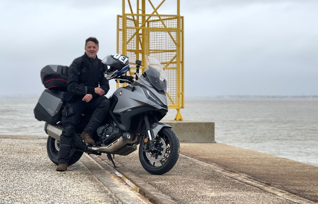
    The adventure together with my wife 

    I don’t remember exactly, but I think I sold it to her as a nice weekend in the only place in France that wouldn’t be affected by Storm Diego! Friday didn’t go much better. We had to overcome some obstacles on a road affected by a landslide near Estérençuby, in the Basque Country. But yesterday the weather turned out to be terrible, just like my plans. 

    We tried our luck on the Iraty side – closed. We also passed (I know, another awful idea) through some lovely snowy areas and even encountered a blizzard. We descended to the valley, and from there on, any attempt to cross the pass proved useless, at the cost of countless detours. 412 kilometers of little roads in 9 hours and 33 minutes, a nightmare! 

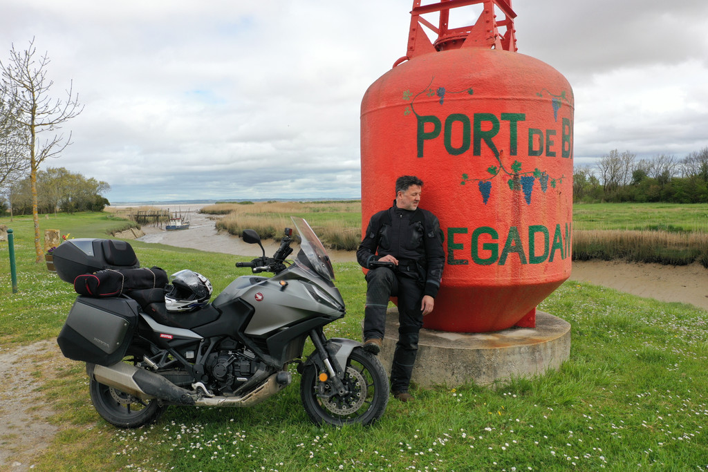
    To restore some dignity to my poor brain and earn a few points, I invited my wife to dinner at the château in Tarascon-sur-Ariège. I told her again about my “Contour de France” concept. At that point, lightning bolts shot out of her eyes. “Contour de France?!” I never know what’s the best technique, telling the unvarnished truth or dressing it up in poetry? I, for example, prefer to tell myself that I’m navigating the land instead of indulging in a load of crap! 

    Speaking of poetry, I know people who don’t hold back from spitting out verdicts without chewing them over for a second, like “Why so many GPS points when all you needed was a map?” I’m a fan of maps, especially 1/25,000 scale ones, where you can really lose yourself in the smaller trails. But given the nature of my trip, I’d need 100 of them! When we can get real benefit out of it, we have to stop fighting progress merely as a matter of principle. 

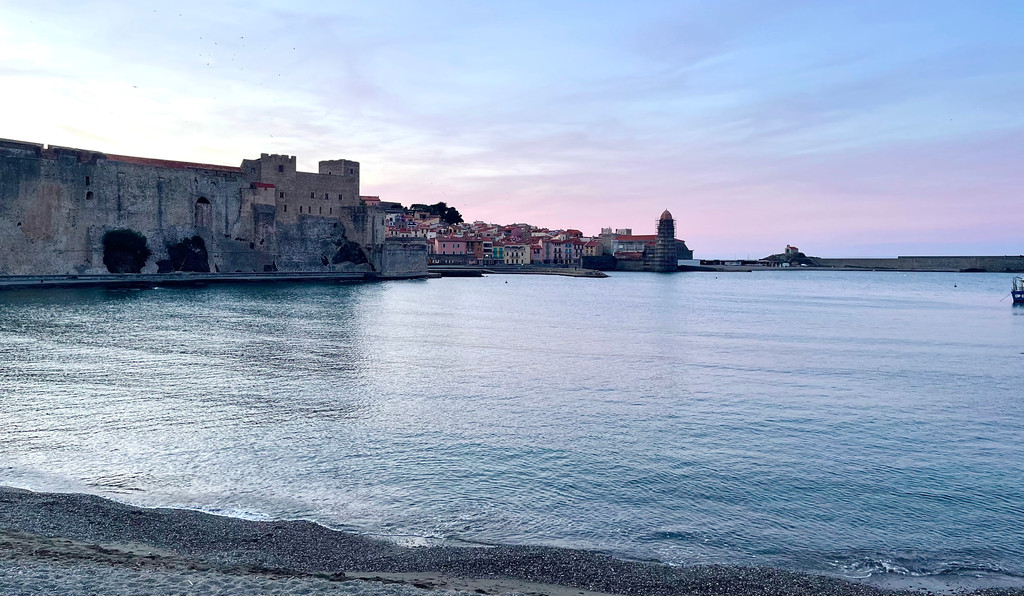
    With Marie we tried, again and again. I would have liked to draw a chiseled, perfect outline of France from top to bottom, but you have to face the harsh reality. It’s too early to cross all these passes and stay closer to the border for my Contour de France. But come on now, we’re not doing that badly. We covered 950 km, where we would only need 456 km to reach Collioure from Biarritz. 

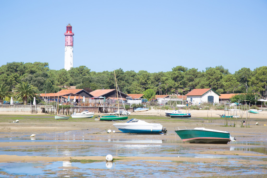
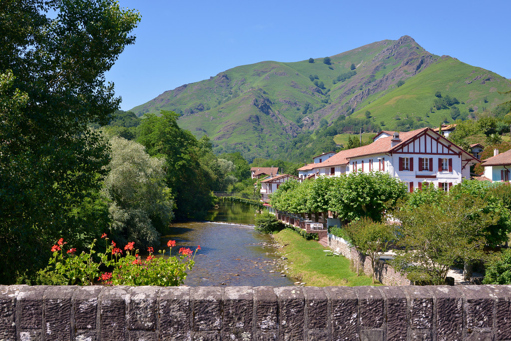
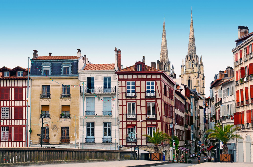
    We started by getting as close as possible to the Spanish border, Saint-Jean-Pied-de-Port, Hendaye, Irun. By mistake, I trespassed into Spain. Come on, I must be entitled to a wild card in this dumb game, right? Then, we started to gain some altitude. Ascain, Sare, Ainhoa, Espelette, Saint-Étienne-de-Baïgorry, Aldudes. How I love the Basque Country. Everything is different there, the architecture of the houses, with their red contrasting with the garish green of nature. The people are marked by simple, unparalleled hospitality. It’s impossible not to make friends… 

    The journey continues along the Pyrenees, Alps, then north along the German border and towards Brittany. Keep reading here: Traveling around France with Lolo Cochet, part 2 – from the Spanish border to Brittany 

    Hendaye beach
    Hendaye beach

    Essential equipment

    211251E2OY_005_1

    Flip-up helmet

    Discover more
    DAINESE22M.0000504_SN006484_CLOSEUP02 (2)

    Gore-Tex Jacket®

    Discover more
    201614072_Q65_F (1)

    Gore-Tex pants®

    Discover more
    201876158_001 (1)

    Back protector

    Discover more
    1795204_001_S (1)

    Waterproof boots

    Discover more
    201815893_V29_F (1)

    Winter gloves

    Discover more
    201915932_604_F_S (1)

    Technical jersey

    Discover more
    201915944_604_F_S

    Technical long underwear

    Discover more
    201634293_14A_F (2)

    Waterproof suit

    Discover more

    Travels you may like

    Traveling around France with Lolo Cochet, part 2 – from the Spanish border to Brittany

    Along collapsed roads and snowy passes between the Pyrenees and the Alps, to breathtaking cliffs over the Atlantic Ocean

    The islands of France with Lolo Cochet

    An unusual journey in the saddle of a BMW R18 Transcontinental